Google Maps Shortest Route multiple destinations
Google Maps Shortest Route: The rise of petrol and diesel prices has made a few extra kilometres driving, costly affair to reach your destination. These days Google Maps has become a lifeline for almost everyone who owns his or her own vehicle because it really helps in the navigation and that too through the best available route.
With the help of Google Maps, users can travel wherever from one location to the other with ease. The traffic and multiple routes available to your destination can easily be intimated because of this navigation system.
 Despite this, you will be surprised that the navigation service also gives us the privilege to measure the distance between two and even more than two destinations. This technology of measuring the fastest route between multiple destinations not only helps us to save our time but also save our petrol or diesel usage.
There are indeed several ways to use the navigation but here we will discuss the easiest way of using this new technology of navigation. These below steps will give you a better idea to calculate the distance accurately and quickly.
If we are using a desktop, the following steps will be used.
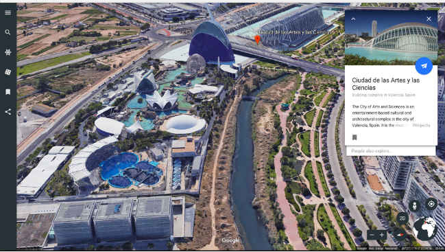
- Open Google Maps in the web browser.
- Zoom into the starting point and then right click on it.
- Select ‘Measure’ distance from the drop-down menu.
- Then click on the second location you want to measure the distance with. In case you want to measure the distance between multiple points then you need to click on all those locations.
- The next step will be you have to drag a point to adjust it in order to map the distance and as soon as you will drag the point you will notice that the calculated distance between the locations at the bottom of the page.And, if we are on our smart-phone, the task may be similar to above; however, the process is slightly different when you use your Android or iOS. You have to use the following steps.
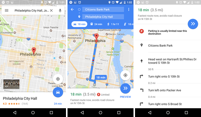
- Open the Google Maps app that you need to install first via play store.
- Locate the first destination and mark it with a red pin.
- After that at the bottom of the map tap the name of the place.
- Now, select the Measure Distance from the pop-up menu.
- Then drag the map so that the black circle is on the next point you want to add.
- You can also add multiple destinations by clicking on Add + option.
- You will now notice the total distance in miles or kilometres displayed at the bottom.